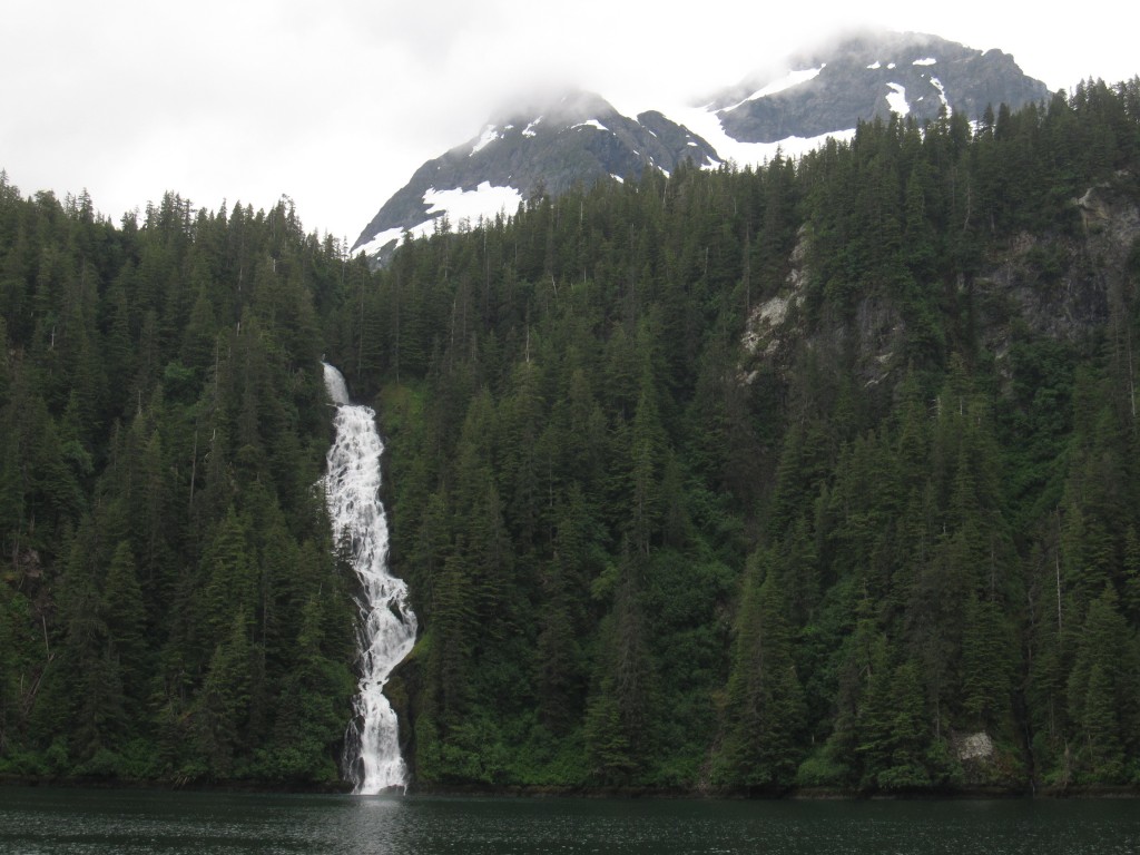
As always in Southeast Alaska, it is pouring rain when we hop into our bright orange dinghy. We’re two days into a nine–day circumnavigation of Baranof Island, and the yacht that I share with four other Forest Service rangers has anchored overnight in Red Bluff Bay – so named for the sheer, reddish–brown cliffs of its northeast ridge.
We’ve come to inspect sites that are of interest to the Forest Service. Today, we’re visiting the remains of a salmon cannery that burned down in the 1950s, a rumored grave site, and then walking a possible group trail to the top of the cliffs lining the bay.
After sixty years, no trace of the cannery’s wooden components remains. We find only several wide rusted pipes embedded at odd angles in the ground, along with other bits of machinery strewn on the rocks. The archeologist takes pictures, and the rest of the team pokes around the site. I shoot a few photographs, but mostly I stay in the dinghy with our yacht’s skipper, Bob. We talk about the coastal landscape, how it becomes increasingly extreme as you travel northward.
Immersed in this tableau, it is easy to forget there is another world beyond Alaska – one which sees the forest not as a biome, but as a farm. I see traces in the remnants of human presence, unsettling reminders that people once overstepped in their attempts to tame the forest. But those traces always seem antiquated enough to fool me into thinking they are far removed from our current reality.
In the coming days, I will learn just how wrong I am: that exploitation of the forest is alive and well in Alaska. But for now, I am blissfully unaware of just how close the two worlds are to colliding, and the ruins are no more than a reminder of the power of nature to reclaim its rightful place.
***
After a brief stop at the gravestone – which turns out to be an amateur papier–maché construction – we boat to the start of the hike. We soon discover that the trail isn’t a trail at all – in fact, there is no trail. The terrain rises steeply from the water, and we’re immediately bushwhacking through a lattice of branches while clambering over waist–height, mossy logs interspersed with gnarly roots. We decide to call it a mountainside scrabble rather than a hike.
After a while, we break through the treeline. The massive old–growth trunks fall away and we’re facing steep stone mounds, surrounded by grasses and the occasional stunted tree. The foliage is no longer protecting us from the rain and I’m soon very grateful for my hardhat, gloves, and rain gear. I’m using hands, feet, and occasionally a butterfly net to gain purchase. Several times I think we’ve made it to the top of the highest ridge, only to discover that there’s another one beyond it. Despite the recurring anticlimaxes, I feel fresh. The rocks are slick with rain, but I manage to stay upright. Must be the butterfly net.
When we do level off, we find ourselves surrounded by grey stone mounds, mosses, grasses, rainwater pools, and stunted trees. This is muskeg, an acidic and mostly infertile bog that supports only the barest of life. A 400–year–old tree here may grow no taller than one foot, its trunk twisted and kinked, barely two inches in diameter. The rainforest is dominated by Alaskan yellow–cedar, Sitka spruce, and western hemlock, but in muskeg the only species that can take hold is usually lodgepole pine.
We clamber around on the rocks for a while, coming across several progressively larger rain pools. Our botanist finds a cluster of rare orchids and takes pictures and a GPS waypoint. Over lunch, the wilderness ranger decides that this landscape is too precious – and the terrain too dangerous – to be opened up to the trampling feet of frequent group tours. We sit in silence, listening to the quiet rustle of raindrops, enveloped by clouds that draw a blanket of silence over the ridge.
***
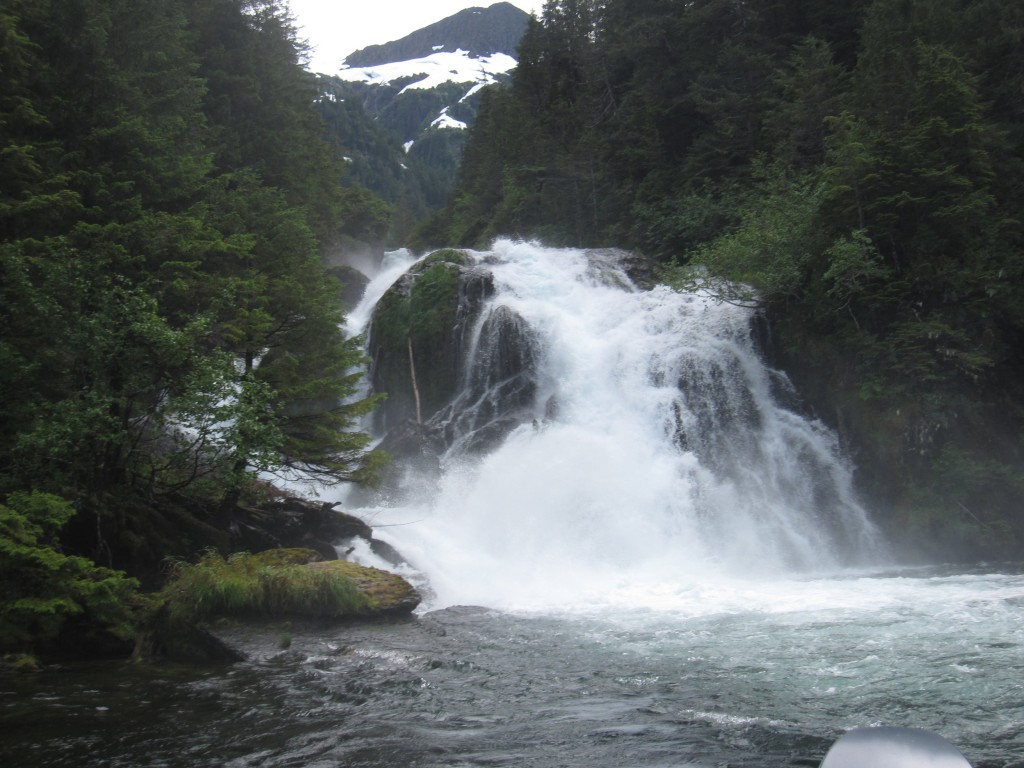
Although I’m from Vancouver, one of the wettest places in North America, I always stayed indoors when it rained. Even gearing up this morning, I’d wished it were sunny so we could see the landscape in all its glory. But now, perched on a rock, watching evergreen needles flutter lightly as drops fall on them, I feel immensely lucky to be seeing this place in its natural state. This is a rainforest, after all.
After lunch, we keep exploring. Making my way through a narrow crevice formed by two large rocks, I drop down into a little gully, and stop sharply.
I’m still in muskeg, but it’s much lusher. The gully teems with plants, and the pines are subordinate to spruce, cedar, and hemlock. Although the trees here are still stunted, they’re much taller than the ones on the other side of the rocks. Some even reach above my head. Mosses carpet the ground, and the foliage of smaller trees cascade over one another like a waterfall. Everything is green, so green that it almost glows.
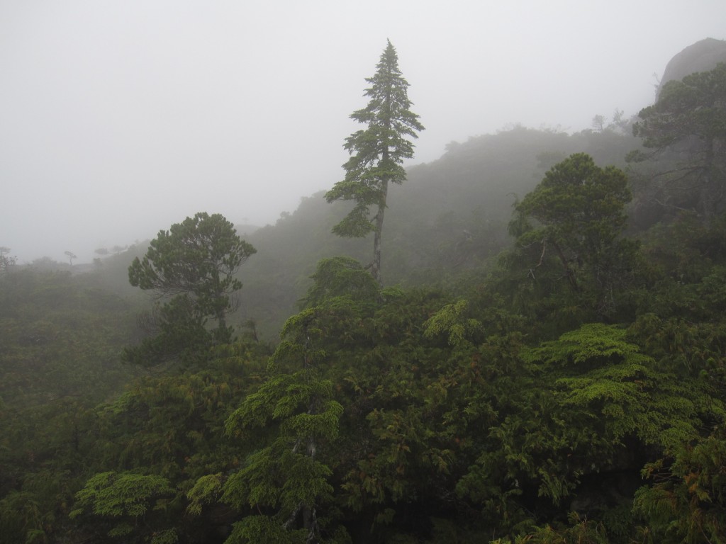
Up the gully, a single tree is silhouetted, standing tall as everything else fades into the fog. A spruce has managed to establish a secure foothold on a knoll, somehow outcompeting everything else, now literally king of the hill. It stands resolute, in defiance of the poor soils and harsh conditions, its only concession its form, its branches forced to congregate on the downhill side. The shape of the gully is perfect for channeling wind from higher elevations, and the breeze inside is noticeably stronger than outside. Decades of one–directional winds have forced it to reconfigure in order to survive.
The fog mutes everything, except for the gently rustling branches and ever–present raindrops. I can’t help standing there for a couple of minutes, feeling honored to be in the presence of this slightly mystical tree. Finally, I make my way on up the gully, reaching out to brush my fingers on the tree’s needles as I pass. I find myself struck with a mild sense of guilt for having disturbed it.
We head back to the water shortly afterward, descending in another scramble, this time down the red bluffs themselves. At the bottom, we end up in a small glade, surrounded by slightly crooked trees and a few old, sharply leaning dead logs. Our botanist calls it the primeval forest, and, snapping another picture, I realize just how true that is. This area is a designated wilderness, meaning that it has likely never been touched by loggers. The trees before us may be centuries old, but the ecosystem itself has been here for millennia.
Later, curled up with a hot chocolate, cabin windows shielding me from the rain as we motor southward on gently rolling seas, I think again about the spruce. I have touched its life briefly, but it was there long before I found it today. Barring any major disturbances, it will remain there, silently asserting its place in the mist, for centuries to come.
Months later, when I find myself back in New Haven, nearly as far removed from the Alaskan rainforest as I can be within the United States. I often find myself thinking of that gully. Alaska is still in my head, and I can’t yet face the rush of the East Coast’s big cities. I don’t know if I’ll ever retrace my steps or find that tree again. I do have the GPS waypoints, so perhaps I’ll make it back there someday. In the meantime, my gloves still smell of yellow–cedar.
***
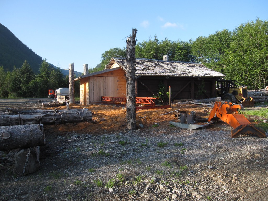
My spruce is lucky: it lives in a wilderness, protected from development. Many others are not so fortunate.
Coastal temperate rainforests have always been the rarest forests on earth. The Tongass was once the northernmost corner of a single great forest that swept the west coast of North America, from California to the Alaskan panhandle. But today, the panhandle contains fully one–third of the remaining old–growth temperate rainforest in the world. The rest has been heavily logged.
The Tongass hasn’t escaped, either. Decades of old–growth clearcutting have left a patchwork on many islands. Prince of Wales, just southeast of Baranof, is maybe the worst example. Zoom in upon the island with Google Earth, and you’ll see the dark green of intact rainforest interspersed with lighter green squares of young or second–growth forest, a sad facsimile of the old–growth that once stood. On Admiralty Island, just to the northeast, the brownish–orange of bare soil and slash scars the landscape, and you’ll have to look away. Most of the island is protected as wilderness, but a little slab at the top wasn’t included, and it was clearcut by a native corporation.
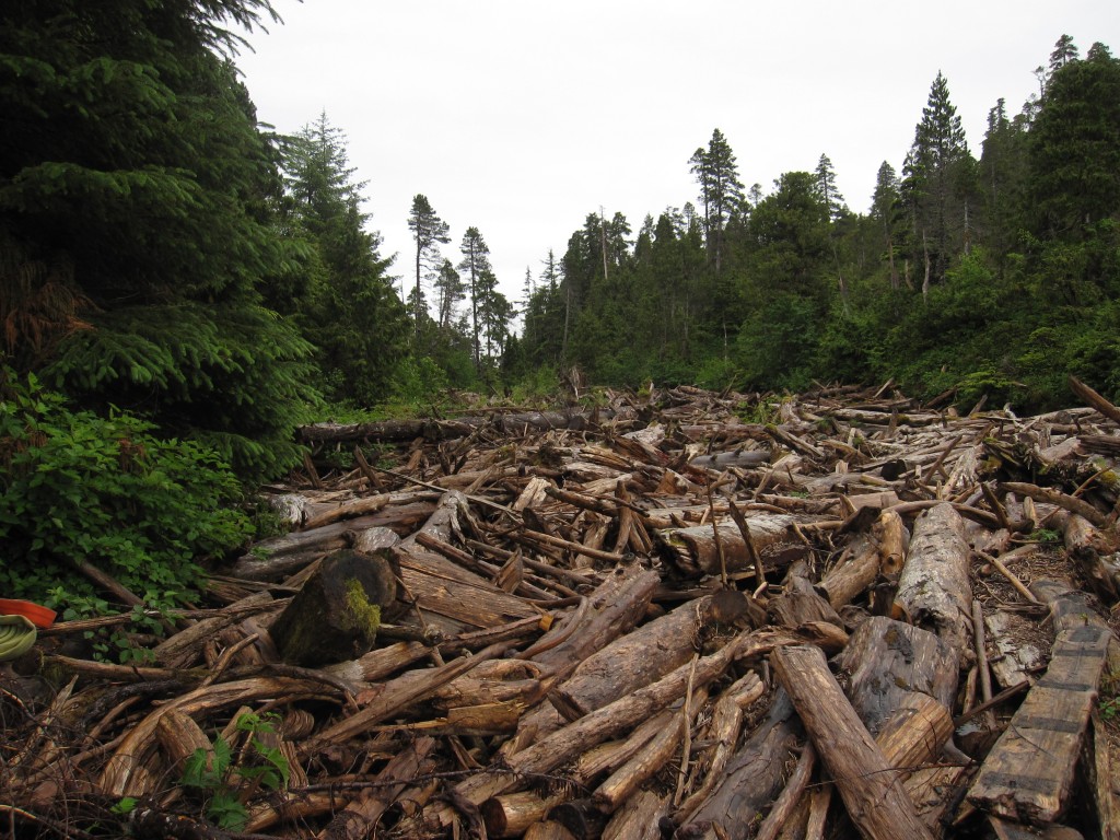
Thankfully, forests grow back. But conditions today are very different than they were a thousand years ago, and nobody knows how long it will take for this forest to regain its structure – or if it ever will. The massive, 800–year–old trunks that anchor the forest and nourish its next generation do not simply – pardon the pun – grow on trees.
In fact, these trees were always few and far between, and never made up more than 6 percent of the Tongass. Today, they make up only 3 percent, barely any of it protected. On top of that, the ‘very large tree’ stands – those with the largest of the large trees – only make up one–half of one percent of the forest, or about 81,770 square acres. These are the trees that are most valuable ecologically – and commercially. They have been overharvested for decades, and at least half have been lost since 1950. On the timescale of our lifetimes, large trees are basically a nonrenewable resource.
The Forest Service has come around in the past years, ending logging entirely in some areas and trying to transition to second–growth logging in others. But the gravest threat today comes from private industry.
***
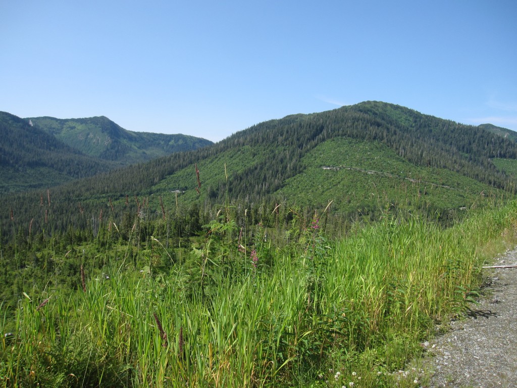
The Alaska Native Claims Settlement Act (ANCSA) of 1971 established thirteen tribal corporations, and gave them the power to claim lands within certain boundaries. The idea was to avoid the failure of the residential system in the lower 48 by empowering natives to determine their own economic futures.
Sealaska is the biggest of these corporations. It has focused heavily on natural resources development, and its environmental record is abysmal, with a long history of clearcutting and high grading. (High grading refers to the practice of cutting only the best and most valuable trees. The forest remains standing, but ecologically the practice is considered only slightly better than clearcutting, since the only remaining trees are ones that weren’t good enough to be cut. Congress banned high grading on the Tongass in 1990, but regulations for private lands are lax.)
It was also the only corporation that didn’t complete its land claims. Or more accurately, it did, but asked the Bureau of Land Management to hold off on conveying the lands. Why? It knew that it would eventually run out of old–growth forest to cut, and wanted a better deal. While the BLM holds its original selections, Sealaska is trying to circumvent federal law – with the help of Alaska’s congressional delegation – to redefine ANCSA’s selection boundaries to include previously off–limits areas.
You can guess where this is going. About one quarter of Sealaska’s new selections are ‘very large tree’ stands – in fact, 12 times more acreage than exists on their current selections. The company has selected most of the remaining old–growth stands that are economical to harvest, plus bays and coves across the Tongass that are valued public lands and essential subsistence fishing sites.
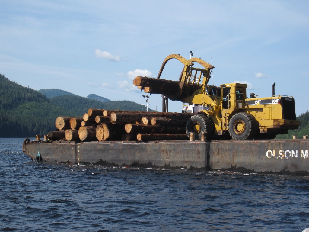
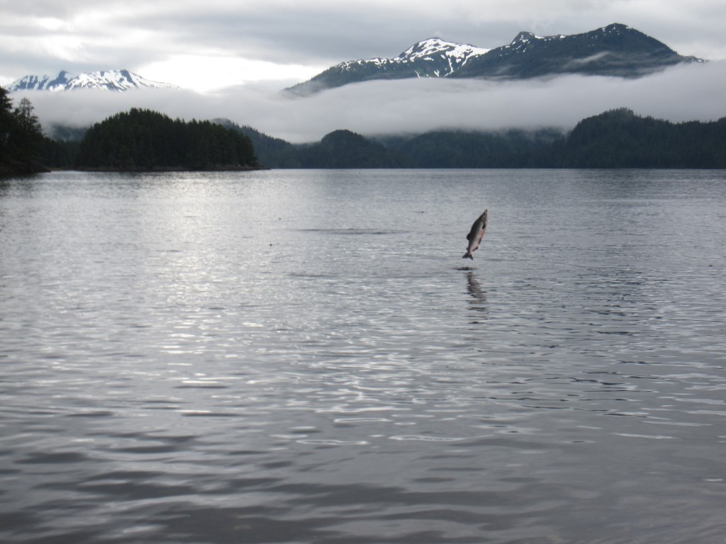
The small forest parcels designated for timber production would become inholdings within the national forest, and would likely be clearcut. As for the bays and coves, aside from those with heavy public usage, Sealaska has selected ten of the twelve sockeye salmon sites within the Sitka use area. In some cases, it has selected just enough land to gain control of the watershed and fishing hole.
For the moment, conservationists and concerned citizens can breathe easy: even though the House bill that would allow Sealaska to capture new logging lands (H.R.1408) passed in 2011, the Senate bill (S.730) died with the inauguration of the 113th Congress in January 2013. But the reprieve is likely temporary. Sealaska has been working toward gaining these lands for at least a decade, and it won’t give up easily. It’s only a matter of time before the bills are reintroduced.
In total, Sealaska would receive about 65,000 acres of public land outside the legal selection boundaries, including some taxpayer–funded infrastructure. Much of this is prime forest land, which would undoubtedly be condemned to destructive forest practices. One may think that 65,000 acres isn’t much, compared to the Tongass’s 17 million acres. But it’s quality, not quantity, that’s the concern here. Fully one–third of the Tongass isn’t forest at all: it’s bare rock, ice, tundra, muskeg, or other terrain not conducive to forest growth. Yes, there are 5.6 million acres of designated wilderness, but these are often low resource value areas. And much of the Tongass has already been cut.
What’s even more worrisome is the dangerous precedent that Sealaska is setting. No other entity, public or private, is allowed to redefine its selection boundaries. What’s to stop Sealaska from doing it again in twenty years when it has clearcut the rest of its land — and what’s to stop another corporation, company, or entity from doing the same thing?
Most people consider this a land grab, and there is widespread public opposition from groups including local towns and communities, tour guides and outfitters, commercial and recreational fishermen and hunters, and even the forest service. Unfortunately, as we have all seen before, public opposition doesn’t always count for much.
***
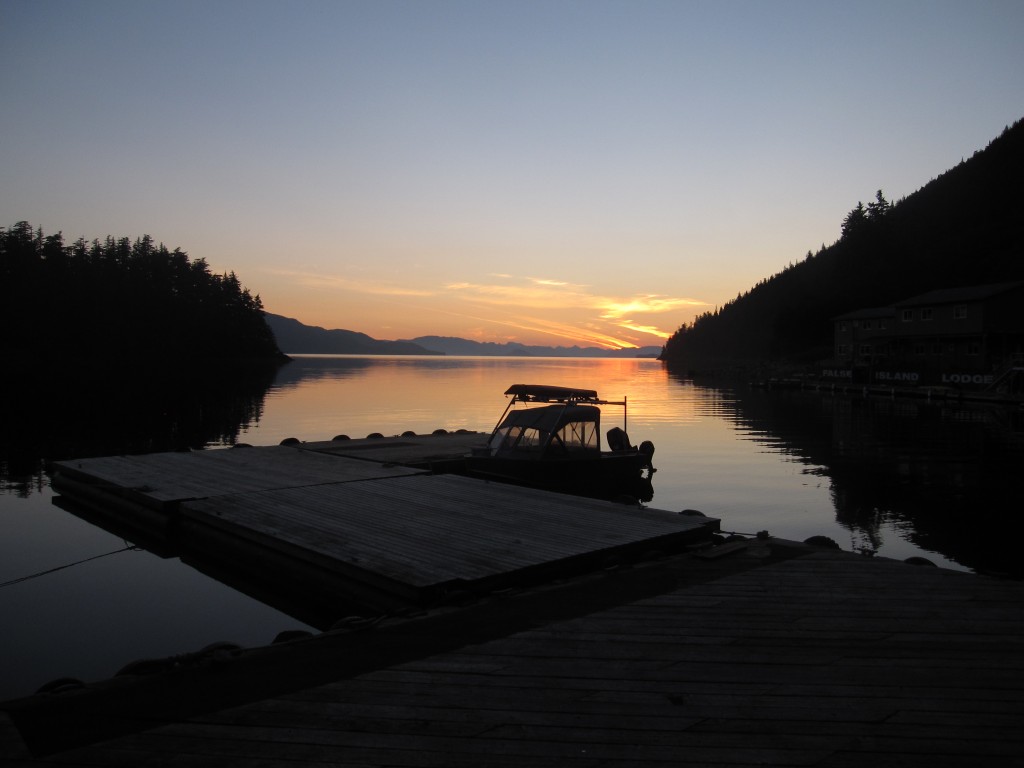
The moral dimensions of a situation like this one aren’t easy to define. On one side is ecological integrity; on the other, the ethical concerns of native rights. I’m not immune to the argument that we have taken so much from the first peoples of this continent that it’s not our place to oppose them now.
But it’s also reasonable to ask whether conservation versus native rights is really the debate here. For one thing, it’s unclear whether the native–owned corporation system is functioning as intended. Evidence is limited, but the results seem to be mixed. At one extreme are corporations that manage their lands sustainably and provide equitable benefits to tribe members. On the other are completely for–profit entities like Sealaska, which has subsidiaries in the U.S., Mexico, Canada, and Europe, and consolidates its wealth high in its hierarchy. Is development really the ethical choice if that development relies on for–profit destruction of a natural resource?
Even if we made that choice in the interest of providing some jobs and income to those supported by Sealaska, what happens when they run out of forest? Will they try and repeat their land grab a decade down the road, and then again a decade later? Either way, prime forest will eventually run out, and they will face the same questions as if they stopped now. The only question is whether there will be anything left. A line has to be drawn somewhere.
The Tongass is often called the crown jewel of the U.S. National Forests, but it’s more than that. It’s part of the ecological endowment of this planet, and though it may lie within U.S. borders, it ‘belongs’ – as much as nature can belong to anything – to all creatures, including all of humanity. Nature doesn’t care about political boundaries, nor does it care what happened in the past.
Why should you care? As a resident of this planet, this is your forest, your ecological heritage, your charge for safekeeping. Conditions in the Tongass can be harsh, and it takes a certain kind of fortitude to survive there. But that makes it all the more special. Whether or not you live in these forests, you have a moral stake in their survival.
All photos courtesy of Naazia Ebrahim.
References
H.R. 987–101st Congress. (1989, November 28). Tongass Timber Reform Act.
Kerasote, T. (2003, September). Land of the Giants. Retrieved 12 05, 2012, from http://archive.audubonmagazine.org/features0309/giants.html
Knight, G. (2011, December 1). Local outfitters opposed to Sealaska land plan. Retrieved from Wrangell Sentinel: http://www.wrangellsentinel.com/old_website/Stories/120111sealaska.htm
Myers, E. F., Walker, N. J., Kirchhoff, M. D., & Schoen, J. W. (2011). High-grading on the Tongass National Forest: Implications of Pending Land Selections on Forest Diversity. Anchorage: Audubon Alaska.
Pemberton, M. (2011, May 26). Forest Service concerned about Sealaska bill. Retrieved from Businessweek: http://www.businessweek.com/ap/financialnews/D9NFD3J80.htm
Poelstra, M. (2012, March 2). Sealaska targets biggest trees in Tongass. Retrieved from Anchorage Daily News: http://www.adn.com/2012/03/02/2348428/sealaska-targets-biggest-trees.html
Robinson, S. (2012, May 23). Congressional Logrolling Threatens to Clear-Cut Alaska’s Tongass Forest. Retrieved from The Blaze: http://www.theblaze.com/contributions/congressional-logrolling-threatens-to-clear-cut-alaskas-tongass-national-forest/
Tongass Lowdown. (2011, September 6). Who We Are. Retrieved from Tongass Lowdown: http://tongasslowdown.org/TL/index.html
